
Derwentwater
Derwentwater is hailed as 'Queen of the Lakes', and is surrounded by some of the most magnificent scenery in the Lake District.
The lake is three miles long by one and a quarter miles wide and is the third largest of the Cumbrian lakes. Derwentwater is a shallow lake, it is only seventy five feet deep at its deepest point, but its average depth is only fifteen feet. This is mainly due to the large quantity of silt washed down into it by seasonal floods. Its shallowness also makes it the first lake to freeze over in the winter.
Derwentwater’s name comes from “River with oak trees'. The river gave its name to Derwent Water or Derwentwater (which was also known as the 'Lake of Derwent' in the 18th-19th centuries).
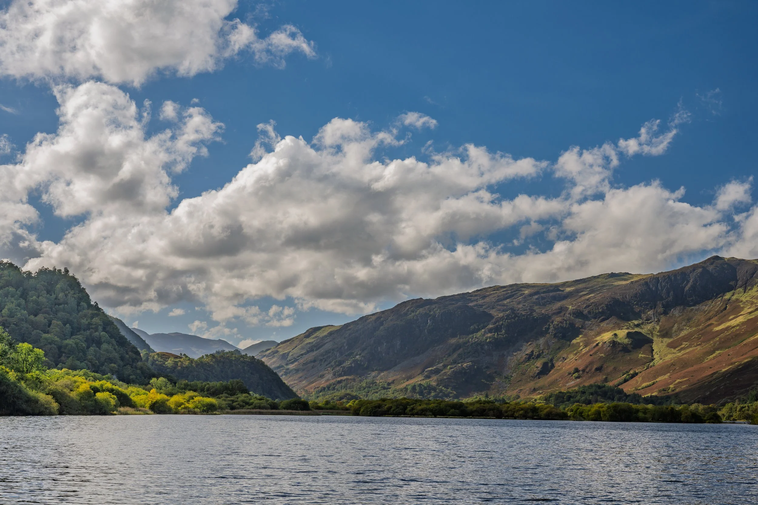
The famous beauty spot of Friars Crag is a short walk from the boat landings near to the main lakeside carpark. The crag derives its name from the pilgrims who once embarked from there to visit St.Herbert's Island. This is one of the most famous beauty spots in the whole of the Lake District, the view across Derwentwater towards Catbells fell is truly breathtaking.

Boat landing jetties on the shore of Derwentwater at Keswick
There are several islands within the lake:
Derwentwater has four islands Derwent, Lord's, Rampsholme and St. Herbert's. Only one, Derwent Island, is inhabited. Derwent Island was once owned by the monks of Fountains Abbey and was once the home of German miners working in the area. Derwent Island House, an 18th-century residence, is a now a tenanted National Trust building that is open to the public on five days each year.
St. Herbert's, at the centre of the lake, is the largest of the islands which covers 4- 5 acres. The island was named after the saint of the same name who brought christianity to the area in 685 and used it as a hermitage.
Lord's Island was once the residence of the Earls of Derwentwater who built a grand house on the island, dating from around 1460, with a drawbridge across to the mainland. The foundations of the house can still be seen on the island.
Rampsholme derives from the Old Norse Hrafns holmr or 'wild garlic island'.
There is a circular walk around the lake but for those not wanting to walk the B5289 Keswick to Borrowdale road runs along the eastern shore of the lake providing a number of accessible locations to reach the lake shore. Just south of the turn off for Ashness Bridge and Watendlath there is a small National Trust car park at Kettlewell. This car park provides access to the southern shore of the lake and gives fantastic views over Derwentwater towards the Skiddaw mountain range.

Friars’ Crag looking towards the Jaws of Borrowdale
The walk starts from the lakeside car park and follows the wide track towards Friars’ Crag. This is probably one of the most visited and photographed locations in the area offering views over Derwentwater towards the “Jaws of Borrowdale”. Friars' Crag derives its name from its use as an embarkment point by monks making a pilgrimage to St Herbert’s Island, where the 7th-century priest and hermit Saint Herbert once lived. Both Friars' Crag and St Herbert's Island are now owned by the National Trust.
Carry on past the monument to John Ruskin and down to the lakeshore at Strandshag Bay and follow the path around the lake. Generally the path is well maintained and there are also sections of raised boardwalk to avoid boggy areas and protect the environment.
The route from Strandshag Bay starts to turn away from the lakeshore and you pass over fields around a wooded area known as The Ings before you return to the shore again. After a short while you arrive at Calfclose Bay and pass the Centenary Stone, also called the 100 Years Stone. This is a sculpture carved from a large boulder of the Borrowdale Volcanic family. The boulder was sawn in half with each face then carved into 10 fan shaped segments of 10 folded wiggles. The stone was laid in 1995 to commemorate 100 years since the founding of the National Trust.

The Centenary Stone at Calfclose Bay

Ashness Jetty
Continuing on past the stone the path is mostly level and follows the edge of the lake however you come to a short sections which involves a short but steep climb over rocks and tree roots to bring you up to the level of the road. You can then follow the road for a short while until you reach a narrow opening in the stone wall that takes you down some steps to Ashness Jetty.
Rather than walk along the roadside you can continue along a narrow rocky path that has a lot of uphill and downhill sections before sloping back to the lake, but at the time I walked this was blocked due to a mix of fallen trees and high water levels. It is worth checking out weather conditions before starting the route to ensure that it is safe to continue.
Ashness Jetty is another popular location for photography with the jetty leading your eye towards Catbells on the opposite side of the lake. The jetty is a working landing stage for the Derwentwater ferry so if you want to return to Keswick this offers launches every hour on the hour clockwise, or on the half hour anticlockwise around the lake during the summer (winter sailings are much less frequent and weather dependent). At this point you can deviate from the walk to take in Ashness Bridge, Surprise Point and Watendlath.
Continue along the path from Ashness Jetty around the shore of the lake towards the National Trust car park at Kettlewell.
The car park is right on the shore of Derwentwater and provides stunning views back up the lake towards Skiddaw.
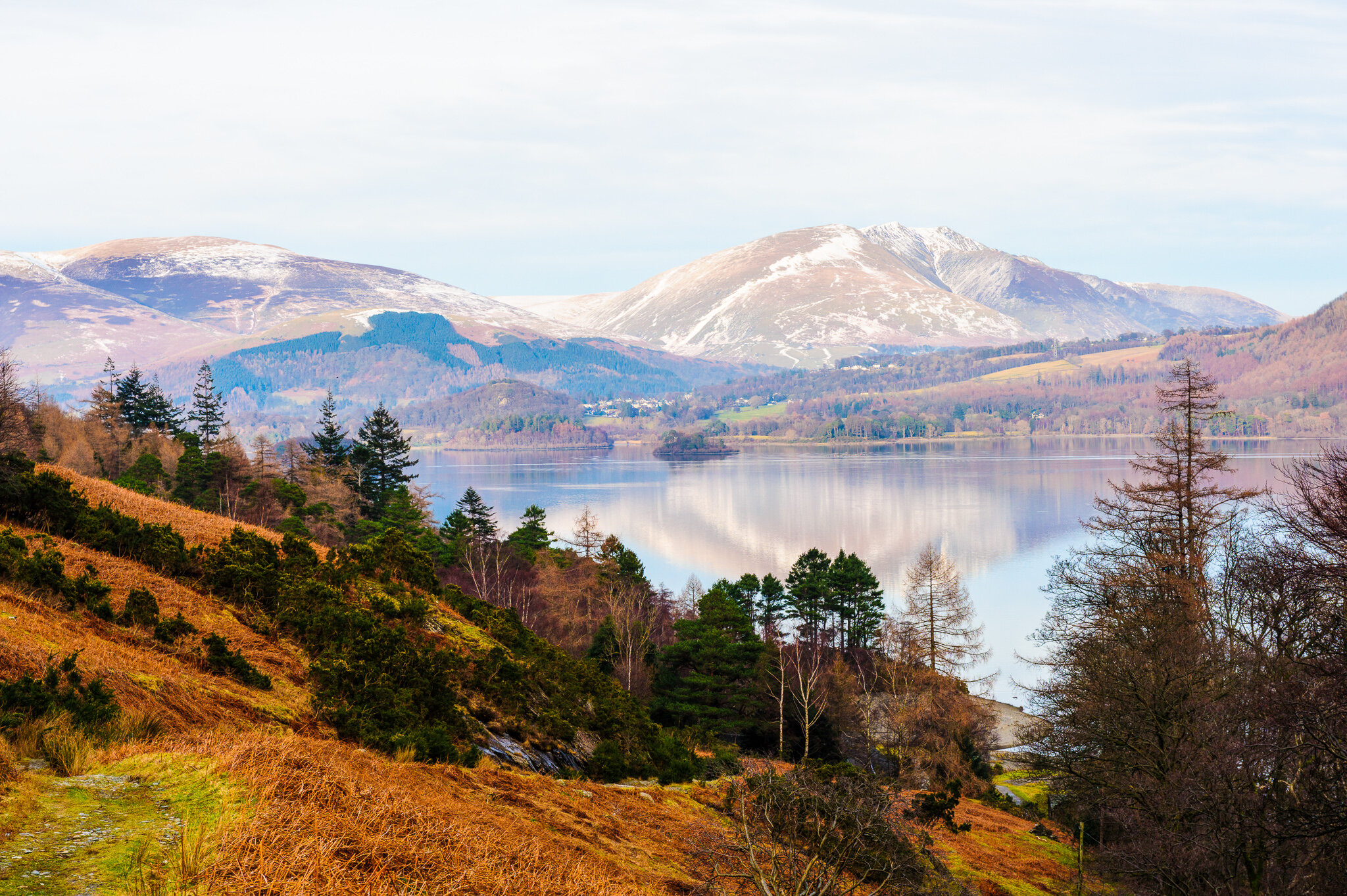
Castle Crag and Borrowdale Valley from Derwentwater
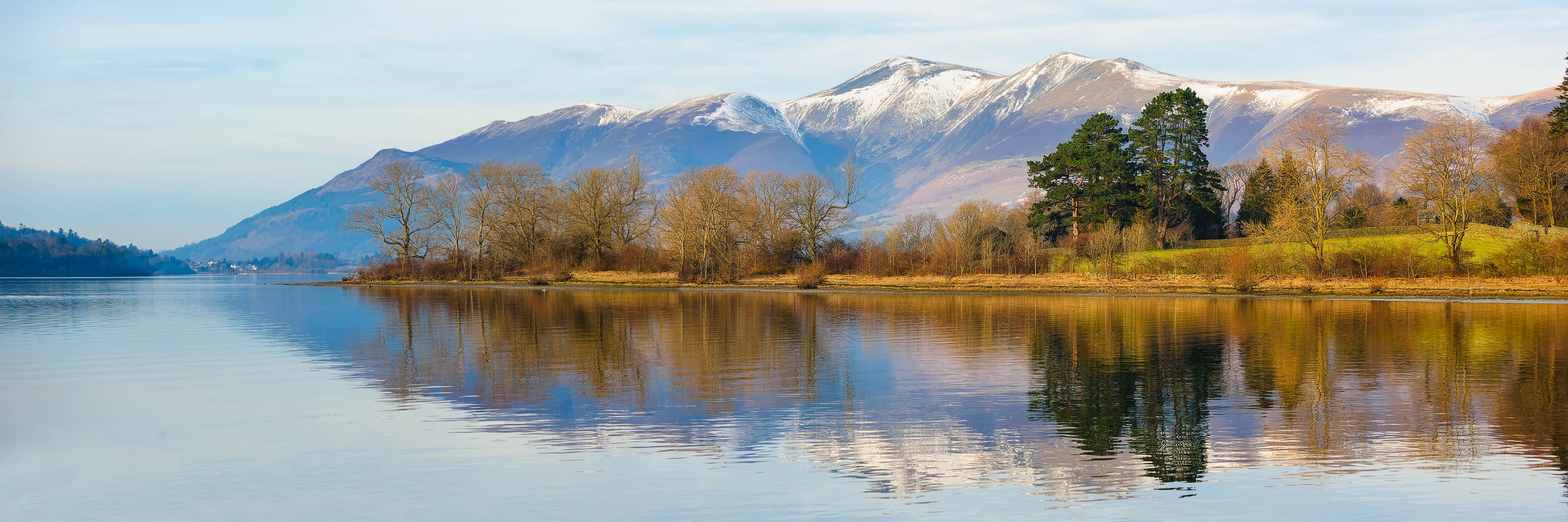
Derwentwater from Kettlewell car park with snow covered Skiddaw in the background
From Kettlewell car park the path crosses the road and through a woodland, always near to the road towards the Lodore falls Hotel. This allows for another short detour to Lodore Falls waterfall. Return from the waterfall back to the main path and onto the road. A short walk along the road past the Lodore Falls Hotel will bring you to the path towards the Chinese Bridge, signposted for Manesty.
This part of the route is often not accessible as the area is prone to flooding so it is worth checking before starting the walk..
Cross the bridge and follow the recycled plastic boardwalk path around Great Bay to the woods. A short section of tarmac path takes you to the oak woodlands at Brandlehow and, from there, a smooth crushed stone path leads along the western shore of the lake to Victoria Bay and Hawse End. The path is flat and easily navigated by wheelchairs and pushchairs and there are a number of picnic tables along the route should you need a break. The route provides some opportunities for stunning lakeside views across Derwentwater towards Walla Crag and Bleaberry Fell but mostly is walking through fields and woodland away from the lake shore. As you pass Nichol End the route becomes more of a road walk, passing through Portinscale,across a small pedestrian suspension bridge and over open fields into Keswick.
At the very end of the route the track passes through Crow Park and starts to approach the lake again.

The view of Derwentwater from Crow Park at the end of the route

Looking away from the lake also provides some good views across to Skiddaw
For those travelling by car, or wanting a further walk you can continue along the Borrowdale road from Lodore Falls Hotel until you reach a turning for Grange. Crossing the bridge over the River Derwent there takes you to an unclassified road that passes along the lower slopes of Catbells on the western shore of the lake towards the village of Portinscale. This road has narrow sections with passing places but there are places where you can park the car for an elevated view across Derwentwater towards Skiddaw.
Derwentwater from Catbells on the unclassified road between Grange and Portinscale
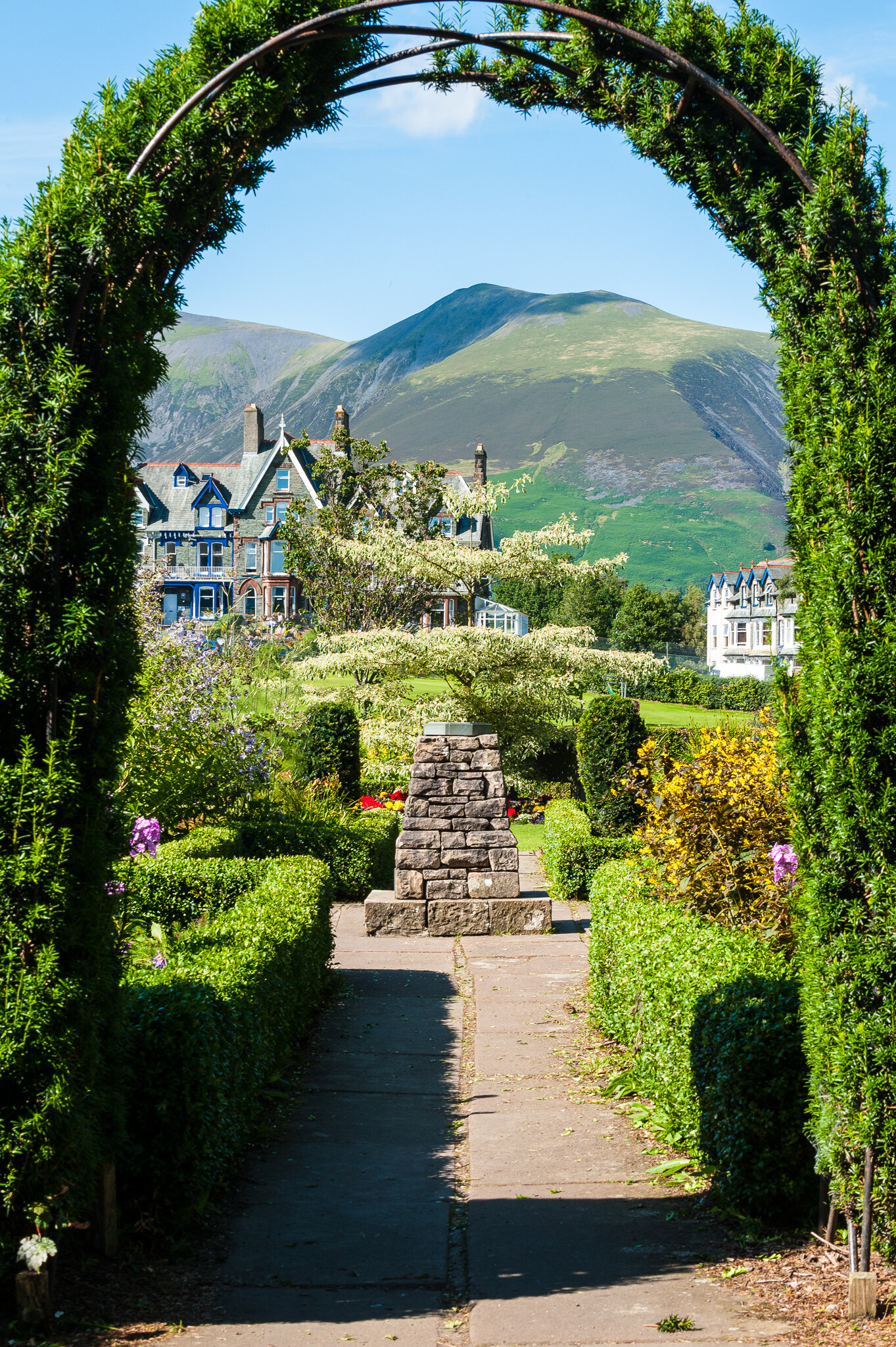
Skiddaw framed by a green arch in Hope Park gardens, Keswick
Hope Park Gardens is one of Keswick's main attractions. Located between the town centre and Derwentwater, near to the lake car park, the park is a favourite stopping off place whilst walking to the lake.
Hope Park has attractive landscaped gardens with a stream and woodland walk, set in magnificent scenery overlooking the fells and provides opportunities to frame the hills in one of a number of arches in the grounds.
Getting There:
Keswick is located just off the main A66 route between Junction 40 of the M6 and West Cumbria. From Keswick head for the Lake car park signposted from the entry to the town centre. This large car park provides easy access to the shores of Derwentwater and the boat launch jetties.
For alternative locations, leave the car park and follow the B5289 Borrowdale Road along the shore of the lake. Not long after the turning for Ashness Bridge you come across Kettlewell car park on the lake side of the road.
Leave the carpark and continue along the Borrowdale road and you will come to a bridge on the right, signposted for Grange. Cross the bridge and follow the road around the lower slopes of Catbells to get views from the western shores. The road returns to the A66 and back to Keswick.
Friars Crag Grid Ref: NY 263 222
Kettlewell Car Park Grid Ref: NY 267 294